Map of the African-American Section of the Cemetery - 2003
This map shows the location of grave markers with identifiable names in the African-American section of the cemetery. The name roster gives the section and numbers below for each grave.

Fairfax Street is to the left
Using shaving cream to read headstones
About This Map
This map was created for a 2003 Boy Scout project by Adam Anderson. At the time, the African-American section of the cemetery had fallen into disrepair. Many of the headstones were covered with lichens, discolored, or eroded to the point of being illegible.
Research of the names that were recorded of those buried were obtained from the records of the Waterford Foundation and the Thomas Balch Historical Library in Leesburg, Virginia. The cemetery was mapped by determining the number of rows, marking them with string, and plotting them on grid paper Then the locations of all tombstones, along with the names and birth/death dates, and other information found was recorded.
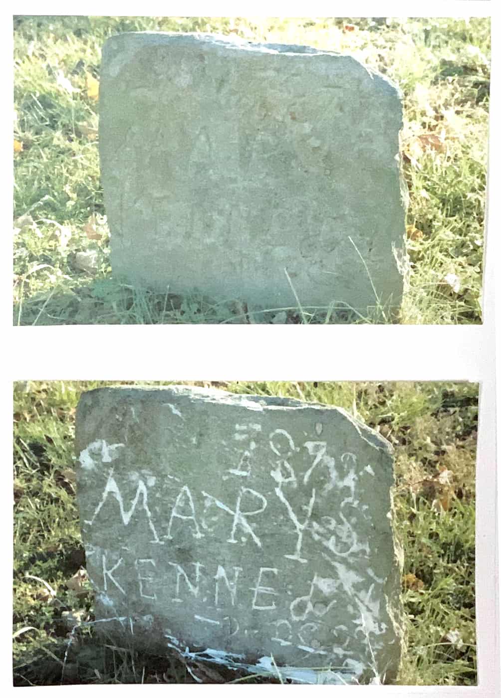
Deciphering the engraving on centuries-old grave markers was a challenge. The project used shaving cream wiped on the stone then wiped off with a window squeegee. The shaving cream filled in the indentations, making the words visible again.
Research and Pre-work was carried out by: Adam Anderson, Julia Anderson, and Jennifer Anderson
Project Data Collection was carried out by: Adam Anderson, Timothy Cotter, Tyler Skinner, Joshua Anderson, Sabe Anderson, Jaxon Anderson, Devon Webb, Jessica Michie, Merideth Wetmore, S. Culbert, Jessica Tuckett, J. Lee, Matthew Hyatt, Regan Anderson, Mason Anderson, Justin Anderson, Nick Clarke, Reed Blauer
Project Write up was carried out by: Christy Lowrey, Jennifer Anderson, Julia Anderson, and Adam Anderson
123 hours was spent on the project.
Newspaper article about the project